Crossing the Red Sea
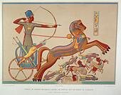
Crossing the Red Sea
August 29, 2020 with later editions
The Bible tells us that it was Moses who led the descendants of Israel out of Egypt to the land of Canaan in a long series of events to complete the Lord’s promise to give the land of Canaan to Abraham’s descendants. The initial step was to liberate the Children of Israel from Egyptian bondage (Ex. 3:8). The second step was to bring His people to Mount Horeb in Midian to worship, as he had directed Moses (Ex 3:12.) There, liberated from Egyptian rule, the Israelites were to receive the basic laws to govern themselves. There, Moses would also organize the Israelites for the conquest of Canaan. Their arrival in Midian at Mount Horeb was to be the sign to Moses that the LORD had sent him and that the LORD would be with him. (Gen. 17:8; Ex 13:5).
Moses’ qualifications for this task were impressive. First, he was Hebrew, but he was raised with the Egyptian ruling class for 40 years, where he would have learned Egyptian culture and technology. He then spent 40 years in the wilderness of Arabia marrying into the Midianite culture, learning religious practices from his Father-in-law and the ways of the Midianite herdsmen.
There are basically two routes out of Egypt to Canaan and to Midian. The Northern route along the Mediterranean coast directly to Canaan, and the southern route to the pass to Midian at Aqaba. The pass from Sinai to Arabia and consequently Midian is called Aqaba, which means “the Pass” (of Ayla) from which the Gulf of Aqaba gets its name.
In his abrupt departure from Egypt 40 years before the Exodus, Moses no doubt took the southern route to Midian, since the northern route was heavily guarded by Egyptian soldiers and Moses was fleeing from the Egyptian Pharaoh. In his return to Egypt he also would have taken this route, with which he was familiar, and since he could not have known the Red Sea would part, would also have chosen this route to take Israel to Midian. This ancient southern trade route was later adopted by Muslim pilgrims coming from North Africa going to Mecca on their Hajj. To reach Midian one had to cross the Sinai Peninsula.
We can be reasonably certain that Moses would have led the Children to Midian by the same route not only because it was better known to him but also because Exodus 13:17–18 states they did not take the direct Philistine route but rather they took the way of the Wilderness of the Red Sea (Judges 11:16). The Wilderness of the Red Sea occupies the southern portion of the Sinai Peninsula between the two extensions of the Red Sea, namely the Gulf of Suez and the Gulf of Aqaba, which flank it on the southwest and southeast. Wildernesses’ generally are uninhabited mountainous regions, the El-Tih mountains being those of the Red Sea Wilderness. (Exo. 13:20).
Moses had told the new Pharaoh the Children of Israel would go three days into the wilderness to sacrifice to the Lord. He had told the Elders of Israel they would go to conquer Canaan. This could not have escaped the Pharaoh’s attention. The Red Sea Wilderness Way starts at the Gulf of Suez and goes east 22 miles to the Mitla and Jabal Heitan passes, which are important defensive military positions. These would have afforded the Israelites some measure of protection from possible pursuing Egyptian soldiers. Alternatively and more likely, although one day’s journey longer towards the south, the Red Sea Wilderness way goes from the Red Sea coast, where three Ramses III inscriptions have been found and then east through Abu Gada near Nekhel where another Ramses III cartouche marks the watering place for the route from Egypt to Midian. Nekhel was a small outpost at that time, which had permanent water. Nekhel (Nahal) means a torrent or brook. Nekhel lies at the foothills of the El-Tih Mountains and therefore at the Edge of the Red Sea Wilderness (Ex. 13:20). The Road going north out of Nekhel leads to the El-Arish wadi, which The Lord later would declare as the border between Israel and Egypt (Num. 34:5). It also leads to Kadesh Barnea from where Israel would twice attempt to conquer Canaan (Deut. 1:46). The Lord however, had told Moses that he was to bring the Children of Israel to Mount Horeb in the Midianite wilderness. It is not a surprise then, that here at Nekhel, or as likely El Thamad identified as Etham (place of permanent water) that the Lord instructed Moses to tell the people to turn from an immediate conquest of Canaan and go to Pi Hahiroth on the Red Sea at Aqaba, another 40-80 miles east by the way the crow flies, along the Red Sea Wilderness way. Telling the Elders of Israel they must first go to Midian would have been a tough sell unless by some miracle (the crossing of the Red Sea) they could see and believe in the Lord’s protection and in Moses’ leadership.
There is little discussion regarding the location of the Land of Goshen or the location of Succoth, the Israelites' first camp, and few would challenge the location of Midian being in the Arabic Peninsula. A petroglyph near Tayma in Saudi Arabia establishes it as part of Midian (OCIANA Oxford Taymanic inscriptions). The route of the Exodus in the Sinai Peninsula however is still in dispute, primarily because it had not been confirmed archaeologically. However, in 2025, a Ramese III inscription was found in the Wadi Rum in Jordan, which when added to the already discovered Ramses III inscription in the Roded wadi of Israel, west of Ayla, and another in Tayma, Saudi Arabia, and to those found in the Sinai peninsula, the route from Egypt to Midian was confirmed archaeologically. These inscriptions mark watering holes along the route and although the markings are dated 300 years after the Exodus they are reliable indicators of the trade route since water was essential for travel and, in the desert, water is limited to specific locations. The Wadi Rum cartouche may also be identified as Paran according to Eusebius who located it 3 days journey east of Ayla. (Onomasticon)
Egypt intermittently controlled the Sinai Peninsula to the Arava but not beyond. The Arava is a long deep valley, which is a geologic fault extending from Africa through the Gulf of Aqaba to the Dead Sea and onward to the Anatolian Fault in Turkey. It runs north and slightly east. It separates the Sinai Peninsula from the Arabian Peninsula. At that time, it was the border between the Egyptian Sinai and the land of the Midianites and Edomites.. And so it was that Moses, under the direction of the Lord, intended to repeat his past experience and take the Children of Israel out of territory controlled by Egypt. This would necessarily mean that he must take them to where he had found refuge in Midian. The Sinai Peninsula would not be safe, since it was proximal to, and controlled by, Egypt. There in the western wilderness of Midian, Moses had had his burning bush experience and he had received his mandate to bring the Children of Israel to that same Mount Horeb, a name which means the mountain of heat (aka volcano) to worship (Ex. 19:18). He already knew the route and the need for a prompt escape from Egyptian territory. The old trade route to Midian, from Egypt directly across the Sinai Peninsula was really his only viable option.
Succoth, the Israelites first camp, is at the western edge of the Sinai Peninsula. Campsites were to be determined by the angel (messenger) who guided them by signal fire and who Moses warned the Israelites to respect( Ex. 23:20–21). These may have been the same messengers who set a fire between the Egyptian and Israeli camps during the crossing, who were Moses’ in-laws, Hobab son of Raguel the Midianite, who also was related to Moses’ father-in-law Jethro, who was priest of Midian. The distance eastward along the old trade route from Egypt to the border with Midian at the bay of the Red Sea, on the Gulf of Aqaba is about 350 km. Judges and Exodus state Israel walked through the wilderness of the Red Sea. There is no wilderness between Ramses and the Gulf of Suez, nor between Ramses and the Bitter lakes. The controversy regarding the Red Sea being the Reed sea and located east of the Nile delta is disqualified since it is not a wilderness.
The Sinai Peninsula connects Africa to Asia by land. There are basically two ancient trade routes by land which people used to go from Africa to Asia since ancient times. The Northern Route follows the Mediterranean shore and the southern Route goes from the northern end of the Gulf of Suez to the northern end of the Gulf of Aqaba. Both gulfs are extensions of the Red Sea and as such the northern end of the Red Sea or ים-סוף which can mean the end of the sea, the Red Sea or the Reed Sea (Eccl. 3:11). The next camp mentioned is Etham. Pharoah no doubt knew that Moses had promised the Children of Israel to take them to the Land of milk and honey. He had tried to reduce the population of Hebrews because he feared they might join his enemies and become a threat to Egypt. Allowing the Hebrews, who were not well trained for war, to attempt to conquer Canaan, would reduce the male Hebrew population, which he had attempted through the Hebrew midwives. When the LORD commanded Moses to turn southeast at Etham and go to Ayla instead of northeast to Canaan, his worst fears would have been realized. At the minimum he would have thought they were lost wandering aimlessly through the wilderness. The route to Midian went through al-ʿaqabat Ayla which means “the pass of Ayla.” Ayla is the later name for Eloth (also written Elath). Josephus called this border “the Bay of Egypt on the Red Sea” (Yam Suf) and “Eloth” and “Ezion-geber.” So the meaning of Suf, reed, red, or the end, is not necessarily a determinant of the location. Upon leaving the Red Sea Crossing, Moses immediately entered the wilderness of Shur, (Exo 15:22) making the Gulf of Aqaba the only possible crossing site, since Shur is the western Arabian peninsula escarpment in the current country of Jordan. Truly it is the “Wall before Egypt,” which its name implies (Ex. 15:22; Gen. 25:18). It is at the limit of Egyptian territory and a serious barrier to travel. Another reliable reference to Shur is that Ishmael was sent east from Beer Sheva to Paran (Gen 21:21, Gen 25:6) and his descendants lived from Shur to Havilah. Genesis 25:18
It is certain that at the time of the Exodus, the Red Sea extended further north, up the Arava, than it does at present. This is borne out by the location of Ezion-Geber, the shipyards of Solomon, which by two different accounts was located north of Ayla (Elath). Deut. 2:8 shows Moses going north up the Arabah from Elath and then Ezion-Geber. Secondly, 2 Chronicles 8:17 shows King Solomon going south first to Ezion-Geber then Eloth. Edward Hull noted the ancient Doum palms lined the shore of Ayla and these palms can be found at Dekel Dom seven miles north of the current shoreline. Older maps such as that of Jean Baptiste D’Anville (1765) show the gulf to be divided by a central peninsular ridge running north and south. This is substantiated by the ruins of Tell Kheleifeh, which are located in the center of the gulf some 500 meters north of the current shoreline. To the west of this peninsula, a nitrous marsh was shown by Robinson and Smith’s map of the “Pass of ‘Akabah” of 1841. The best estimates place the sea level, at the time of Moses, at one meter below the present due to subsequent polar melting, which together with subtracting the windblown sand from the north, and the alluvial fill from the Wadi Yutim of the pass of Aqaba to the east, and the alluvial fill of the Wadi Arava, and Nahal Roded, would have made this area a tidal mud flat in Moses’ time. Boreholes on the eastern Jordanian side of the gulf studied by Alivia J Allison of the University Missouri- Kansas City, show an earlier Holocene clay mudflat. The western arm of the Red Sea would have had similar findings but somewhat later as the Yutim Wadi alluvium continued to fill the Gulf. The ruins of the Tel Kheleifeh fortress may have included a tower and since it is strategically located in the center of the Gulf, it may have been a signal tower and protection for ships coming up the Gulf to load Egyptian copper from Timna. Mary-Luise MusselI dated it to 13-12th century BCE. It could be the Migdol of the Pi Hahiroth camp by the Red Sea before the crossing. Pi Hahiroth means the “mouth of the channels”. Three channels discharged into the Red sea at a single point at this location namely the Nahal Roded, the Wadi Yutum and the Wadi Arabah. The Israelites would have had to cross the Red Sea on the tidal flats further to the south, which was formed by these wadi between what was formerly the Eilat airport and the Tell Kheleifeh ruins, which are separated by a distance of 1.3 miles.
The Geologist Edward Hull visited Ayla in1883 and gave a helpful description of this location. First he felt the Red Sea extended further up the Gulf in the past. He described the tides at Aqaba as 6 feet in 1883. The average height of the Egyptians at that time was 5 ft. 6 in. Sir Colin Humphreys argued that Pi Hahiroth, the last campsite before the crossing, would need to be at the location of an underwater ridge. The ridge would be exposed due to water set-down by a strong wind over a long watercourse, at this location, such as occurred the night of the crossing of the Red Sea. Current wind set down measurements at Aqaba are up to 40cm and the difference between high and low tides at new moon, which would have been 2 weeks after Passover, maximize at the moon’s perigee at 2.2 meters. Sir Humphreys felt the tide had little to do with the crossing, but the Israelites would have arrived on the new moon 14 days after Passover which is the time of lowest and highest tides. Neither mechanism should be discounted as they would be additive. The western half of the Gulf at Eilat was funnel shaped and would produce tidal bore, which would have made the crossing perilous, sweeping the Egyptian army into the Pi Hahiroth as the tide returned. The Egyptians would have been impeded by the clay mud, through which Egyptian chariot wheels were not designed to go(Ex.14:25). A good reference to this is Major Kitchener’s account of the Mount Seir, Sinai, and Western Palestine expedition page 208, which refers to the difficulty crossing at Acaba due to the mud. The Broadening of the channel as the water flows southward would have caused the sedimentation in the tidal flat as water slowed down entering the Red Sea.
Immediately North of what Josephus called “the Bay of Egypt on the Red Sea” and “Eloth” and “Ezion-geber,” is found a large area of uniform elevation, the Evrona Playa. The Playa may have been the now silted in deep water port of Ezion-geber. It is currently about 50–70 feet above sea level. The Eastern extension of the Gulf would have since silted in from the Wadi Yutum, which drains the Aqaba Pass. The Alluvial fan formed by this wadi would also have obstructed the Wadi Arava to form this plain. This now silted in port of Ezion-geber would place the Red Sea on both sides of the crossing and PiHahiroth between the sea and Migdol. The exodus occurred in the middle of a 500 year period of increased rainfall by sediment studies at the Dead Sea. The mudflat caused by the alluvium of Yutum would be the underwater bridge on which the Israelites crossed. It does not need to be an underwater ridge and since there is a transverse geological fault at the lower end of the Evrona Playa, which could impede flow from the salt flats above, the crossing could very well have been a narrow strip of land not wide enough for an army but certainly wide enough to be a crossing.
The Shehoret hill just west of Pi Hahiroth is dark in color. Baal Zephon means the Dark Baal. Since Baal was worshiped on every high hill it meets the description for the campsite of the Crossing. If viewed from Solomon’s Shipyards Pihahiroth is halfway between the Sea and Migdol, if Migdol is the tower at Tel Kheleifeh. The ancient palm trees at Dekel Dom north of the Playa are of the same species mentioned by British explorers of the 1800s as lining the gulf of Aqaba lending further credence to the Evrona extension of the Gulf.
This considerably narrows the search for the crossing site. Coupled with the wind set down from the east wind, which blows south at this location, the crossing of the Red Sea would have occurred on dry ground in the tidal flats formed by the aforementioned Wadi as noted by Colin Humphreys in his book entitled The Miracles of Exodus. Points further south, which have been claimed as crossing points by several well meaning researchers, but with liberal doses of poetic license, defy logic. All these locations require water to stand several hundred meters high. The word “wall” which they point out to be a vertical barrier, was used by Abigail’s servant metaphorically to describe David’s men protecting them and their flocks in the desert. The Evrona playa and the Gulf would have been the walls, which kept Pharaoh’s army from surrounding the Children of Israel during the crossing of the Red Sea. This forced the army to follow the Children of Israel and subsequently perish in the returning tide.
It would be advisable to check the salt marsh north of Eilat for Bronze artifacts and lunate microliths at a depth consistent with low tide in 1500 B.C.E. The depression, which is between Tel Kheleifeh and Aqaba, was surveyed by Jordanian archaeologist Faris Saadeh in the spring of 2020. He specifically sought lunate microliths, which were used as arrowheads by the Egyptians during the New Kingdom period as well as bronze military artifacts. Several of these arrows were removed from the tomb of Hatshepsut in the 1930s and now reside in the New York Metropolitan Museum of Art. Faris Saadeh’s survey concluded that the construction of Hotels and Marinas in the previous 8 years had substantially altered the 1500 B.C.E. shoreline rendering excavation impractical. The Israeli side of the Gulf is the more likely location and will doubtlessly suffer a similar fate if not surveyed in the near future. Such a study would serve to confirm this area as the crossing site or in the absence of findings support a different location.
July 2025
In April of this year a cartouche of Ramses III was discovered in the wadi Rum in Jordan. It marked the road taken by the Egyptians to get to Tayma where another such cartouche has been located. A third such marker was found in Israel on the Roded wadi at a perennial spring making the route Moses would have taken to Midian a near certainty, since only 300 years passed between the Exodus and Ramses III marking the watering places along the route, Each of these indicate water sources along the trail from Egypt to Midian and now constitute the archaeologic evidence of the Route Moses took in his original escape as well as his return to and Exodus from Egypt although a short cut through the Mitla pass cannot be ruled out.. Traveling down the Roded the discharge of which is directly opposite the discharge of the Yutum and then Up the Yutum, which is the Pass at Aqaba would be the actual route Travelers would have taken and most certainly the actual site of the crossing of the Red Sea. A line drawn between the Ein Netafim (Roded) cartouche and the Rum wilderness cartouche in Jordan crosses the now silted in Red Sea crossing, where to this day the crossing from Israel to Jordan is found. The exact spot is likely to be near lake Anita so an archaeological expedition for Pharaoh’s army’s remains to the depth of sea level is warranted at that location.
Archaeological evidence for the Exodus was provided by Geraldine King, who discovered an inscription by a descendant of the tribe of Hobab among the inscriptions in the wilderness east of Amman Jordan. (OCIANA Oxford). Hobab was Moses' brother-in-law who scouted the trajectory of the exodus providing intelligence and tactical support to Moses (Num. 10:29–31). Moses warned the Israelites not to interfere with his support (Ex. 23:20– 21) and later asked him to continue his service to Israel. The word “angel” in both Hebrew and Greek means messenger. The word Evangelical (the good message) is derived from it. Archaeological evidence for the location of Midian is also found in the numerous references to Midian’s relatives (Dedanites) and Midian itself in the inscriptions of al Ula and Tayma.
In summary, one of the most important events in the history of the Children of Israel, the crossing of the Red Sea was in fact a miraculous and clearly historical event, which is referred to in many places in both the old and new Testaments as evidence of God’s direct intervention in the lives of his people. It will most likely be confirmed archaeologically, when better archaeological tools allow its direct identification under the 3 millennia of alluvial sediment in the now silted-in Gulf of Aqaba.