The Geography of King Solomon's expedition for Gold of Ophir
The Geography of King Solomon’s maritime expedition to Ophir for Gold
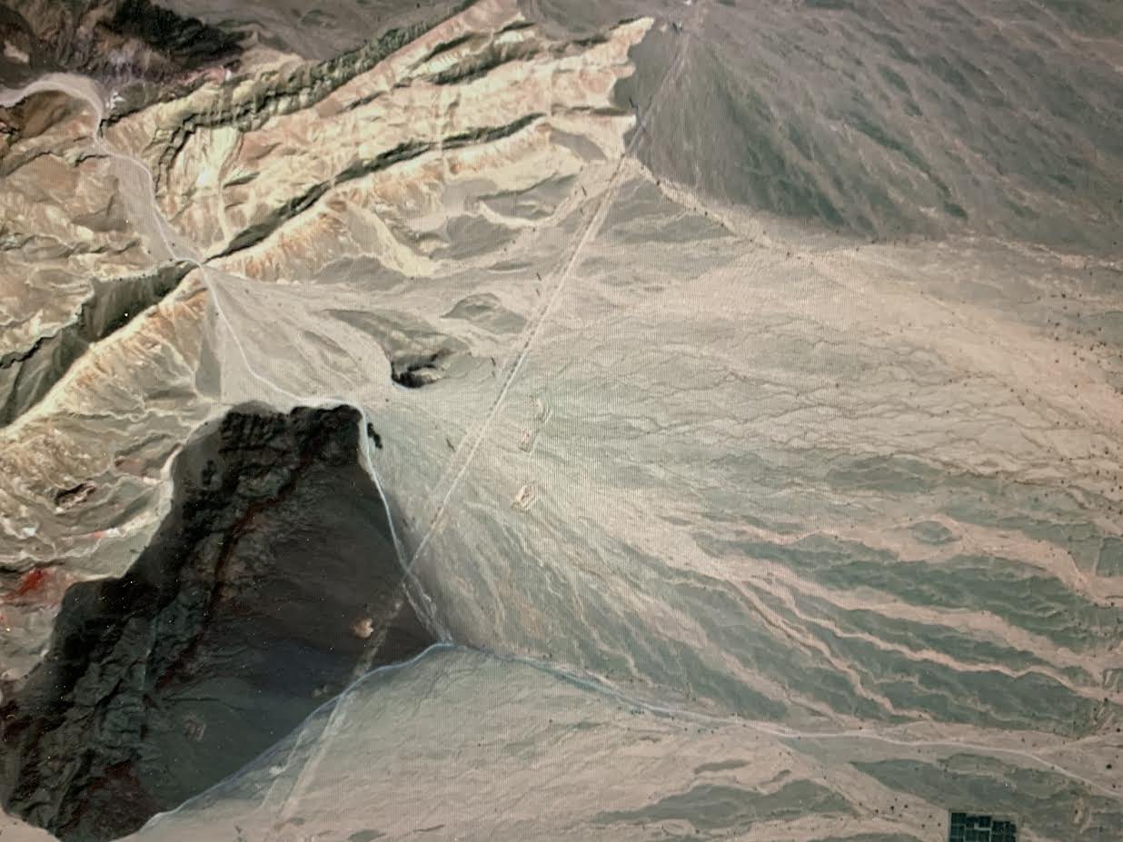
King Solomon’s mines have recently been shown to be at Timna where he mined copper. These lie 15 miles north of the current shoreline of the Gulf of Aqaba. His shipyards were at Ezion-Geber which although not proven archaeologically, may have been located approximately 6 miles north of the current shoreline at the intersection of the Nahal Amran and what was in that time frame an extension or estuary of the Red Sea. Deuteronomy 2:8 shows us that Ezion-Geber was near to Elath but in the Arabah as one goes north to Edom from Elath. Its position on the shore of the Red Sea near to but north of Eloth is confirmed by 2 Chronicles 8:17, where Solomon went to Ezion-Geber and then to Eloth from Jerusalem going south in Edom to the seaside. This is reconfirmed in 1 Kings 9:26. Ezion Geber means the Spine of a strong mighty man. The Nahal Amram flows through a geologic formation of white cliffs about 3.5 miles west of the Evrona playa, which take little imagination to give the impression of a Giant’s Spine . The Evrona Playa is located in the old estuary of the Red Sea. Moses camped here twice with the children of Israel and both they and the shipbuilders of Solomon would have needed a source of water which the Nahal Amran would have provided. This area is the current location of the Evrona Farms. Although currently dates are grown here, 1.25 miles to the north in the Dekel Dom Nature Reserve are found Doum Palms which were described by the Irish Geologist Edward Hull as lining the shore of the gulf of Aqaba in the 1800s.
Loading copper or copper ore from Timna 11 miles to the south at Ezion-Geber, Solomon’s expedition would have circumnavigated the Arabian Peninsula passing from the Evrona Estuary to the Gulf of Aqaba, then to the Red Sea, the Gulf of Aden, the Arabian Sea, and then to the Persian Gulf to arrive at the Euphrates River. They would have sailed or rowed up the Euphrates as far as Sippar (Sephar) an ancient trade center on the Euphrates River. 2 Chronicle 3:6 names the city Parvaim which is short for Separviam or Sephar where the gold for the temple was obtained. The copper and possibly other items such as frankincense would have been traded for Gold. Sephar is a word derived from sepher which refers to a document. Here in Sephar tens of thousands of documents written in clay have been found, which are primarily records of business transactions. Trading in gold has been documented here in Sephar for more than a milenneum prior to Solomon. NABU 1987-55 Walid Al-Jadir &Khalid Al-Alami. The Gold in Sephar would have originated further upstream in the land of Havilah and Ophir, because 2 Chronicles 3:6 states the gold was from Parvaim but 1 Kings 9:26-28 states the gold was from Ophir. Havilah and Ophir were two brothers who lived from Mount Mesha, a mountain of Mesopotamia going in the direction of Sephar. Genesis 10:29,30. The Land of both Havilah and his brother Ophir are noted to be sources of high-quality gold. Genesis 2:11,12. The nearby city of Mardin is still known for its goldsmiths. who would have had a local source for their occupation.
The Book of Job supports this location. Job was the greatest man of the East (Mesopotamia) Job 1:3. Job was told he would lay up the gold of Ophir like stones of the brooks Job 22:24 and that gold came from the North of Mesopotamia. Job 37:22. (Literal Hebrew)
Although the route from Sephar to Jerusalem is much shorter by land, the transport of 420 talents of Gold would have been much more difficult by donkey or ox carts, which require significant amounts of hay and attendants not to mention the risk of bandits along the land route. The Equivalent weight in copper would have been considerably more difficult to transport by land in these quantities.
Mount Mesha was described by Strabo the Greek Geographer as a mountain in Mesopotamia which he labeled Masius around the time of Christ. The river which flows from Mesha towards Sephar through Havilah is the Khabur although in the time of Moses it was called the Pishon. The Pishon originated in the Garden of Eden on Mount Mesha. Genesis 2:11
Solomon’s expedition for the gold of Ophir helps to tie together geographically, the books of Genesis, Exodus, Kings, Chronicles, Ezekiel and Job.